Protruding Land
Today, protruding land. The University of Houston's College of Engineering presents this series about the machines that make our civilization run, and the people whose ingenuity created them.
I've just learned the true answer to the question, what's the westernmost point in the contiguous United States? No, it's not California. I'd thought it was the Cape Blanco light house in Southern, Oregon; but it's not. It turns out that Alava Cape on the northern tip of the Olympic Peninsula reaches eight miles further out into the cold Pacific. Since I did high school and college in Oregon, I didn't like seeing that prize moved to Washington State.
Still, the two capes have much a lot common. Both are rocky, treacherous, and isolated. In 1887 the three-masted Austria was headed from San Francisco to Tacoma. Austria had begun as a Clipper ship and was now re-rigged as a bark. As it rounded Alava Cape in a nighttime gale, the captain drifted too close to shore -- between the Cape and the nearby Flattery Rocks. At dawn he tried to steer the ship out of the rocks and failed. One rock tore the hull open. Luckily, friendly Indians came out to rescue them.
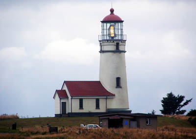
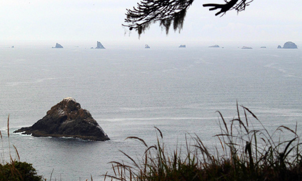
Oregon's Cape Blanco is even more treacherous. It too is a gauntlet for passing ships. Any ship that gets within three miles of it will have to dodge its weird jagged rocks. Nine ships have been lost there, and the story of the first is grimly ironic.
![]()
Click on the thumbnail above to see a very large 360-degree panorama of the Cape Blanco Light setting
 Since the Cape is so dangerous, construction of a lighthouse was begun there in 1868. When the Schooner Bunkalation arrived two years later with building supplies, a storm beached it. It might've survived, but its cargo included quicklime -- add water and heat is released, lots of it. The resulting fire finished the Bunkalation.
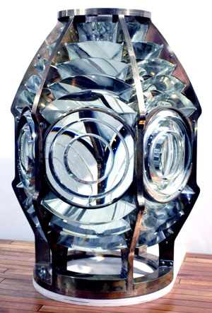
The Cape Blanco light was finished a few months later and equipped with one of the new Fresnel lenses, worth about a third of a million of today's dollars. After that, the light saved far more ships than were wrecked. The lens was worth it in human life.
The last ship lost off Cape Blanco was an oiler. It struck the rocks five days before Christmas, 1919, killing thirty sailors. Protruding land does that. Pollock Rip, a narrow stretch between Cape Cod and Nantucket, first deviled shipping in 1620. It redirected our history by forcing the Mayflower to divert to what became the Plymouth Colony. And the king of capes protruding from the US is Hatteras, North Carolina -- holding court over a litter of sunken ships that includes the famed Union gunboat Monitor.
The story is the same in other parts of the globe. We know what a threat to shipping Cape Horn is, below Chile's Tierra del Fuego. And we know South Africa's Cape of Good Hope to be benign. But there's a catch. The Cape of Good Hope is a hundred miles northwest of the true tip of Africa, Cape Agulhas. Under the waters off the Agulhas Light lie 140 mapped shipwrecks.
And, the few of us who've been to the remote Cape Blanco Light have felt the chill -- of fog, wind -- of danger -- of sailors' ghosts. Like any land that presumes to encroach upon the sea, it forfeits all the comfort that solid land is meant to provide.
I'm John Lienhard at the University of Houston, where we're interested in the way inventive minds work.
(Theme music)
A great deal may be learned about these locations by exploring each with the help of Google Earth. See also the Wikipedia sites on Oregon Shipwrecks, Cape Blanco, Alava Cape, Cape Hatteras, Cape Horn, and Cape Agulhas. All photos by J. Lienhard.
Below: A typical smaller Fresnel lens from 1855 and a view of one string of rocks in the ocean just southwest of Cape Blanco:

