Measuring America
Today, we measure America. The University of Houston's College of Engineering presents this series about the machines that make our civilization run, and the people whose ingenuity created them.
In 1807 Thomas Jefferson put a Swiss engineer named Ferdinand Hassler in charge of a new government agency. It was the Coast Survey, later called the U.S. Coast and Geodetic Survey. When I did road surveying 150 years later, we called it the "USGS," and we did so with a certain awe. We normally measured 100 feet within 1/8 of an inch. From the start, the "USGS" refined measurements to ten times that accuracy.
Jefferson charged Hassler with staking out our new country as accurately as anyone could. For 35 years, Hassler did just that. He began by placing two benchmarks, one in western Connecticut and the other in eastern New York. Then he worked away from these markers, up to Maine, and down toward Florida. Every two kilometers, he set a stone monument that located a position and an elevation.
He worked with maddening care. He spent 45 days running one eight-mile base line on Fire Island. He got only as far as southern New Jersey during his lifetime. But the work has gone on ever since. Today you're never more than a few miles from a small bronze marker, embedded in stone or concrete, with a warning that you'll be fined if you disturb it. One sits on top of Mt. Whitney, giving its elevation as 14,494.777 feet, give or take a few thousands of an inch.
The vision of Jefferson and Hassler is reflected today in a great spider web of 500,000 benchmarks. The whole system refers to one primary marker on a ranch in Kansas, near the center of America. The precision of the network takes account of variations in gravity and changes in the earth's curvature.
The system is nearly invisible until you face a problem of making ends meet in the middle. We need such precision when we build a railway, highway, bridge, pipeline, or communications system. And woe betide the surveyor who doesn't tie his measurements to this fine network.
Pennsylvania highway department engineers used their own benchmarks for a bridge in 1969. They built outward from either side and learned how imperfect their markers were only when the two halves missed each other by 4 feet. The New Jersey turnpike is marred by corrective S-curves, because the various stretches of highway were tied to inferior benchmarks.
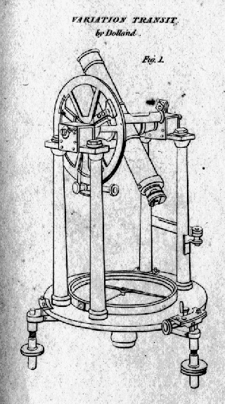
The "USGS" system was begun with the same old telescopic transits and levels that I still used when I was young. Now they're very nearly museum pieces, and I'm left to wonder: How could Jefferson have seen it all coming? How could he and Hassler have known? What trick of vision ever let them see so far?
I'm John Lienhard, at the University of Houston, where we're interested in the way inventive minds work.
(Theme music)
Wilford, J.N., A Continent Beneath the Ice. The Mapmakers. New York, Vintage Books, Random House, 1982, Chapter 20.
I am grateful to Albert E. Theberge, Jr., Librarian with the National Oceanographic and Atmospheric Administration (NOAA), for providing the following web sites that recount the dramatic history of NOAA, and its various earlier incarnations (which include the Coast Survey and the USGS). He points out that it was actually the United States Coast and Geodetic Survey that placed the markers we sought out during my old road surveying days.

From the 1832 Edinburgh Encyclopaedia
Early-19th-century surveyor's transit