Antarctica
Today, we explore earth's last frontier. The university of Houston's College of Engineering presents this series about the machines that make our civilization run, and the people whose ingenuity created them.
In 1935 the great polar explorer Admiral Richard Byrd remarked:
It's a curious ... fact that long after most astronomers [knew] there were no canals on Mars, no geographer ... could have told you whether Antarctica ... was one continent or two.
Antarctica was first sighted in 1820. For a over a century geographers had tried to figure out what -- on earth -- it was. Was it a collection of islands? Was it floating ice, as large as the United States and Europe put together? Some people expected to find a lush inland garden around the South Pole.
Finally in 1898 an explorer named John Murray came before the Royal Society to present 25 years of study. He spoke with careful scientific reserve. "We are," he told them,
in possession of abundant indications that there is a wide extent of continental land within the icebound regions of the southern hemisphere.
But what form did that land take? Huge ice shelves indent it in two places. Were there really two separate continents under all that ice? Maybe it was just a huge atoll.
Murray's dry talk became a stirring call to arms. It triggered a great exploratory effort. Ships sniffed about the edges. Amundsen's dogsleds reached the South Pole. By 1928 airplanes joined the struggle to learn what was there.
But the Antarctic mysteries didn't yield easily. Airplanes flying over the featureless wastes couldn't keep track of flight patterns. Mountains reported by one explorer would vanish for another. Compasses misbehaved near the pole.
Some of the mystery began yielding to modern instruments around 1960. First sensitive gravity meters, then seismic and radio echo soundings, revealed the depth of ice and what lay under it. A huge continent did indeed lie below, although the peninsula reaching out toward South America may yet prove to be separate. Large subsurface seas are found where geothermal energy rises to melt the bottom ice.
The strangest finding of all is the topography of the land. Instead of rising inland, Antarctica is ringed with mountains. Their peaks reach within a few hundred yards of the ice surface. But inland, elevations drop far below sea level. The inland ice is often two or three miles thick.
We know a little today, but the rest is still mystery. What's in the land below? What promises does it hold for earth? What can it tell us about the formation of our planet and the nature of our being? Mystery is the great animator of the inventive mind. We hunger for it, and Antarctica still gives us much to feast upon.
I'm John Lienhard, at the University of Houston, where we're interested in the way inventive minds work.
(Theme music)
Wilford, J.N., A Continent Beneath the Ice. The Mapmakers. New York, Vintage Books, Random House, 1982, Chapter 18.

Stereopticon image courtesy of Margaret Culbertson
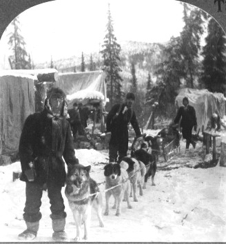
An early 20th-century dog sled north of the Arctic Circle