Rocks, Air, and Memory
Today, our guest, geologist Peter Copeland tells us about rocks, air and memory. The University of Houston presents this series about the machines that make our civilization run, and the people whose ingenuity created them.
The consequences of natural disasters are devastating -- earthquakes, volcanic eruptions, floods. If we hope to be ready for them, we need to understand their magnitude, frequency and effects. We also need to understand the different circumstances that bring them about.
An earthquake occurs when stresses that have built up in rocks are more than they can resist. The frequency of earthquakes in a given region depends on how rapidly tectonic forces accumulate, and on the character of the geologic formations present. If the stress doesn't abate, then the chances of an earthquake increase.
Here's an example of the relationship between time and likelihood of an earthquake: the segment of the San Andreas Fault in central California near the town of Parkfield. The fault marks the boundary between the North American plate and the Pacific plate. It experienced six, moderate, magnitude-six, earthquakes from 1857 to 1966. Their average recurrence was 22 years. Scientists figured this segment of the fault was pretty predictable, so they deployed an array of instruments in and around Parkfield in the late 1980's and waited for the next earthquake.
They hoped to gain a better understanding of the processes of rock mechanics by having their equipment near the source. Each year without an earthquake, the likelihood of one increased. That's because systems like these have a memory. Stress in the rocks accumulates, making failure of the rock more and more likely. Finally, in 2004, Parkfield again was shaken. (In this case, it took 38 yers for an earthquake to repeat.) Now, just a few years after the last quake, the chance of another magnitude-six earthquake near Parkfield is quite low. But, in two or three more decades, we can reasonably expect another.
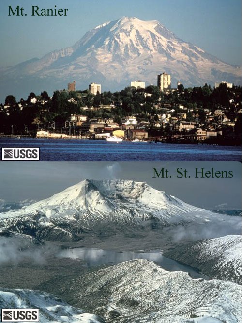
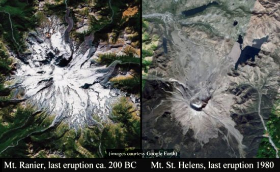
The chances of an eruption from an active volcano similarly go up as time since the last event increases. We should be much more concerned about an eruption from Mt. Ranier near Seattle, whose last significant eruption was about 2,200 years ago, than we are of Mt. St.
Helens, 50 miles southwest of Ranier, which erupted in 1980.
However, the chances of disasters whose source is in the sky -- tornadoes, hurricanes, floods -- do not increase as time passes without an event. Unlike the rocks, the sky has no memory; yesterday's weather may have some residual effect today; but today will have no effect on conditions a year from now. In 2005, Hurricane Katrina devastated New Orleans. A few weeks later, Hurricane Rita bore down on, but ultimately missed Houston.
Does this mean that New Orleans is off the hook with regard to tropical cyclones, but Houston is in some way "due"? No to both! The Big Easy cannot breathe easy nor should Houston be any more concerned than it was in 2004. Hurricanes are worrisome, but we have to remember that the likelihood of future of storms is independent of the past. Houston should plan for hurricanes because of where it is -- adjacent to the Gulf of Mexico -- not because of what did or did not happen last year. The rocks have a memory of earthquakes and volcanoes. Storms are another matter. The air quickly forgets what happened, just the other day.
I'm Peter Copeland, at the University of Houston, where we're interested in the way inventive minds work.
For more on the last Parkfield earthquake, Mt. Ranier, and Mt. St. Helens, respectively, see the U.S.G.S. pages on the: Mt. Ranier eruptions, and Mt. St. Helens
Peter Copeland is an Associate Professor in the Geoscience Dept. at the University of Houston, where he has taught for 17 years. His research has focused on the evolution of the continental crust with particular emphasis in the Himalaya and Caribbean. From 2001-2004 he was editor of the Geological Society of America Bulletin.


(image courtesy of Google Earth)